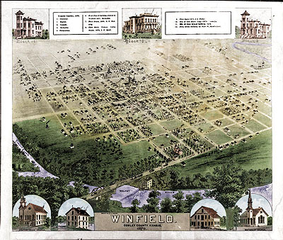
Maps of Winfield, Kansas in the 1870's

Winfield, Ks in 1878. Photo of original by Rex Flottman
Original Map in the Cowley County Historical Museum, Winfield, Ks.
(I think this map was probably drawn by John Hoenscheidt, architect
& surveyor, possibly under contract with the publisher. John Hoenscheidt
also drew a detailed Cowley county map and a Winfield map in 1880. We are
seeking copies of these maps)
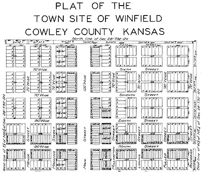
 PLAT MAP OF THE TOWN SITE OF WINFIELD 1872
(use WHIP 4.0 plugin This is a vector
file)
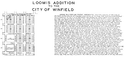
 LOOMIS ADDITION TO THE CITY OF WINFIELD
1878
(use WHIP 4.0 plugin This is a vector
file)
High Altitude - High Resolution Photograph
of Winfield in 1991
Twenty Dollar Bank Note from Cowley County National
Bank Winfield 1911
Check written on M. L. Read's Bank
in 1875
Back to Maps page
Austin Business Computers, Inc. Home Page
Bill Bottorff's Home Page
comments to Bill Bottorff, bbott@ausbcomp.com


